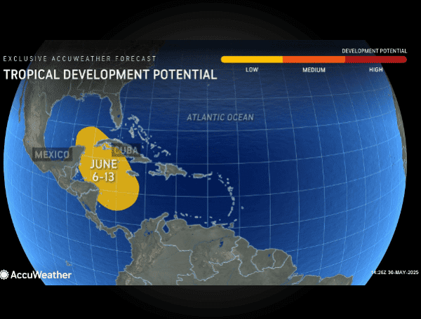
As the official start of the Atlantic hurricane season kicks off tomorrow, Sunday, June 1st, AccuWeather meteorologists are already pinpointing a window for potential tropical development in the second week of June, raising concerns for areas from the Caribbean to the Gulf of Mexico, and potentially the United States.
While the tropics are expected to remain relatively quiet for the immediate days following the season’s commencement, a shift in atmospheric conditions could spark activity between June 6th and June 13th.
READ: NOAA And CSU Forecast Above-Normal 2025 Atlantic Hurricane Season, Urge Preparedness
AccuWeather Tropical Meteorologist Alex Duffus highlights a “pulse of low pressure” moving from east to west globally, coinciding with a surge of moisture and a reduction in disruptive winds across the western Caribbean and southern Gulf. These factors combine to create a favorable environment for a tropical depression or storm to form.
The first named storm of the 2025 Atlantic season will be Andrea. Its eventual track will hinge on its rapid intensification and the prevailing steering currents at the time of its formation. However, meteorologists indicate a possibility of the system drifting into the Gulf of Mexico, making landfall in the U.S. mainland, or slowly weakening over Central America, southeastern Mexico, or Cuba before mid-month. The Florida Keys, in particular, could experience impacts between June 10th and 13th.
Click here for full article and video: https://www.msn.com/en-us/weather/topstories/don-t-blink-atlantic-hurricane-season-kicks-off-with-early-storm-threat/ar-AA1FQfwX?ocid=msedgntp&pc=DCTS&cvid=4d23c7f90e794bbb996bc1713ed94f9a&ei=10